Fire smoke made my photo-taking challenging, but the area is stunning.
Start with watching this short 6-minute "fly through" where I outline the entire trip.
Just finished this and it was absolute perfection... you've inspired us to experiment with our own additions to trails now, big thanks - Reddit
BACKGROUND
What is the Skyline Six-Pack of Jasper's Skyline Trail?
The Skyline Six-Pack is a series of six summits that can be hiked while backpacking Jasper Alberta's skyline trail. These side trips enhance the experience by providing unparalleled, bird's-eye views of the landscape as you progress along the trail while adding an extra challenge that can be tailored according to ability.
I promise you this: it takes the already breathtaking trail and elevates it with a stunning and spectacular perspective from high above.
Completing the Skyline Trail itself is a great accomplishment, being 44 kilometers long with an elevation gain of 1410 meters. But for those who have the physical ability and desire to challenge themselves with more, the Skyline Six-Pack adds 18.5 kilometers to the distance and an 1861 meters elevation gain through five side trips to six summits along the trail. If the full Six-Pack is completed, this brings the total trip up to 62.67 km with 3217 meters elevation gain.
Because all the peaks are side trips from the standard Skyline trail, there are no rules - choose whether you'd like to do one, two, or all of them. If you have the ability to hike the standard Skyline route, you will surely be able to add at least one of these peaks to your trip.
I did the trip over three days. However, some people may want to add an extra day or two according to ability or to accommodate days of bad weather.
Only 1%
Only 1% of my trips are on this website. For loads of unique adventure ideas browse my Youtube channel - they're all there with more being added all the time!
When to do the Skyline Six-Pack of Jasper's Skyline Trail?
Because it involves going significantly higher than the highest point on the actual Skyline trail (the Notch at 2510 meters) snow can be an issue early in the season. I did it in the first week of August of 2021, the year of record-setting heat and had no issues. But lingering snow on Curator and on the descent of Trowel could be a problem in years of more normal temperatures, so I'd suggest that August would be the earliest to attempt it to avoid disappointment and unsafe conditions.
Do I haul all my backpacking gear up the peaks?
No, that's insane! When I get to the beginning of a side trip route, I jettisoned all gear except for what I'd need for the side trip with the exception being that I took along ALL of my food - never leave your food unattended except in a metal bear bin at a campground. I would transfer everything I didn't need into a trusty black garbage bag and stash that behind some scrub brush or rocks - this is the alpine; there are no trees. Peaks 2 and 3 were done by starting from a Snowbowl campground, so I left all gear and extra food at camp in that case. See a photo of a gear stash below.
Do I need to do all six? Are there options?
Since they are all side trips from the Skyline trail, you certainly don't need to do each peak. I even offer alternative peak ideas so you can mix it up according to how you feel/weather conditions, etc. Do less, making a Skyline Two-Pack, do more, making a Skyline Ten-Pack. There are no rules, challenge yourself as you wish, and remember, completing the Skyline trail itself is a great accomplishment and amazing experience!
How will my times compare with yours?
This is a tough call as everyone moves at different speeds, some take more breaks than others, etc. I'd suggest that my times are on the lower side unless you in fact know that you're a fast hiker/scrambler. On Day 1, you'll have to do 22 kilometers and 1610 meters elevation - 600 meters of that will a full backpack - and this took me 8.5 hours. If you're experienced you should have a good idea of how much time this would generally take and you can adjust my times to your expectations accordingly. If you're unsure of how long this would take you, you'd best leave a couple of hours earlier the first day to see how you compare to my times. From that, you'll know how to adjust times going forward.
Which campgrounds shoud I stay at while on the Skyline Trail in Jasper?
I'd suggest Snowbowl and Tekarra. Add another night at Curator if you want shorter days. Watch the video below for a walkthrough of the campgrounds and my thoughts about each.

Stashing your gear while climbing peaks. There's not much you can do in the alpine.
Day 1
I parked at the Signal trailhead at the north end. Most people hire the shuttle service or set up a car shuttle, but I elected to try to hitchhike to the south Maligne trailhead - it only took ten minutes before I was offered a ride.
Beginning at the Maligne lake trailhead, you start easily as you spend a couple of hours hiking through the forest, slowly gaining altitude until you pass Evelyn Creek camp after 5 km, where things get real and the trail begins climbing. At 8 km you reach Little Shovel camp and shortly thereafter reach the open meadows below Sunset Mountain where things flatten out. A short climb brings you to Little Shovel Pass where you can jettison your gear and do your Peak #1. From there, you continue down the other side of the pass to the meadows that lead to Snowbowl Campground. Set camp, and then set off for Peaks #2 and #3 as an afternoon trip.
My totals with summits: 8.5 hours, 21.71 km, 1610 m elevation gain.
(just hiking to Snowbowl camp: 12.2 km, 650 m elevation gain.)
Peak #1: Sunset Mountain
Sunset Mountain - Parry Loeffler.gpx
* This track is not meant to replace a guidebook. Consult a guidebook for route information. This track is not high resolution, so don't rely on it for route finding at a micro level *
While Sunset is not a difficult summit, I chose it because it's the first scrambling option you come to on the trail, is a great warm-up, and gives great views of what lies ahead.
Stats:
- Distance: 2.32 km
- Elevation gain: 249 m
- My time: 67 minutes
Peak#2 and #3: Mt. Aberhart-Trowel Peak Traverse
Mt. Aberhart-Trowel Peak Traverse - Parry Loeffler.gpx
* This track is not meant to replace a guidebook. Consult a guidebook for route information. This track is not high resolution, so don't rely on it for route finding at a micro level *
These can be combined as a magnificent ridge walk loop with an Olympic-quality scree descent. Aberhart is a step up from Sunset, with some steep sections requiring some easy scrambling and the descent off Trowel is steep, requiring comfort on scree and some route finding. *TIP: I think my GPX track shows me attempting to circumvent a small bump along the ridge traverse by side-sloping left of the ridge - well, don't do it because it's tedious and not worth it! Stay on the ridge.
Stats:
- Distance: 7.19 km
- Elevation gain: 711 m
- My Time: 3 hours 15 minutes
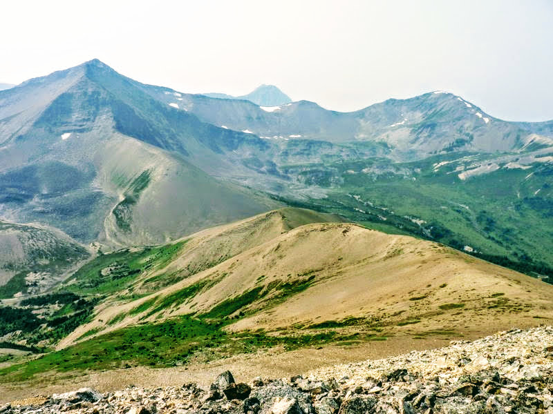
Terrain around Mt. Aberhart.
Day 2
I hope you got a good sleep, because this is the most scenic day - but also to most challenging. It took me about 15% (1.5hrs) longer than expected, with all of this being consumed climbing Tekarra which proved more challenging than I'd anticipated.
Setting off from Snowbowl, you once again enjoy a gentle warm-up, hiking through the alpine meadows before the climb up the Big Shovel Pass. There, you jettison your gear and climb Peak #4 if it's in shape. Returning you then enjoy great views as you follow the trail along mountain slopes to Curator Lake, where the most challenging climb of the Skyline trail itself begins up to the highest point of the trail - the Notch. Once reaching the Notch, things level off as you catch your breath along the high alpine, passing just below the summit of Peak #5 where you drop all your gear and make swift work of attaining the summit before continuing onwards slightly descending to where you decide whether to tackle Peak #6. After that, it's all descent into the next valley which leads you to the Tekarra Campground.
My totals with summits: 11 hours, 27.76 km, 1651 m elevation gain (just hiking Snowbowl camp to Tekarra camp 18.7km, 750 m elevation gain.)
Peak #4: Curator Mountain
Curator Mountain - Parry Loeffler.gpx
* This track is not meant to replace a guidebook. Consult a guidebook for route information. This track is not high resolution, so don't rely on it for route finding at a micro level *
Curator is ascended after climbing up to Big Shovel Pass. It can hold some snow up higher so you need to evaluate its feasibility from there before attempting it. You may see snow blocking the ridge up higher. When I got there, I found I could pass around it on the ridge crest on the right, but this is steep with loose scree and would be too steep if still covered in snow. A better way would be around the left on gentler terrain if free of snow.
Stats:
- Distance: 2.62 km
- Elevation gain: 328 m
- My Time: 1 hour 25 minutes
Peak #5: Amber and Amber NW1 Mountains
Amber and Amber NW1 Mountains - Parry Loeffler.gpx
* This track is not meant to replace a guidebook. Consult a guidebook for route information. This track is not high resolution, so don't rely on it for route finding at a micro level *
Amber is the easiest peak in the Skyline Six-Pack, but after climbing to Big Shovel Pass, up the Curator, and then up the Notch in the day to this point, you'll be glad for an easy win!
As you crest the ridge of Amber following the Skyline trail, you see a rounded mound on your right and a more interesting rocky summit on your left with a large cairn on top. Some maps show the rounded mound as the summit, so you can easily traverse atop it and call it a summit, but I thought the more distinct, cairned summit was much more impressive and just as high so I went to it as well and would call it Amber Mountain NW1. Take your pick, one or the other, or both.
Stats:
- Distance: .3 km
- Elevation gain: 37 m
- My Time: 7 minutes
Peak #6: Mount Tekarra
Mount Tekarra - Parry Loeffler.gpx
* This track is not meant to replace a guidebook. Consult a guidebook for route information. This track is not high resolution, so don't rely on it for route finding at a micro level *
The crown jewel of the Skyline Six-Pack fittingly finishes it off. This is the most challenging peak so you need to check in on how you feel before attempting it. If you don't feel 100% physically or if you were at all uncomfortable with the terrain on any of the previous peaks, skip it because there are other easier options further on during Day 3 to attain the final peak of your six-pack. Until this point, Aberhart was probably the most technical with some easy scrambling sections, but Tekarra is a level or two beyond that with some solid moderate scrambling and challenging route finding to keep it at that level.
Stats:
- Distance: 6.14 km
- Elevation gain: 536 m
- My Time: 2 hours 41 minutes

Mt. Tekarra.
Day 3
This day is short, so feel free to sleep in a bit. Once on your way, cross the stream and hike around the lower flanks of Mount Tekarra, slowly gaining elevation near alpine. Soon you contour around Signal Mountain, Peak #7 - Huh? You thought this was the Skyline Six-Pack? Well, if you're up to it or skipped Tekarra or another peak, you have a final chance to add an easy makeup or bonus peak. From there, you shortly join the Signal road for a 9 km descent to the trailhead.
My totals with summit: 5 hours.
Peak #7: Signal Mountain
Signal Mountain - Parry Loeffler.gpx
* This track is not meant to replace a guidebook. Consult a guidebook for route information. This track is not high resolution, so don't rely on it for route finding at a micro level *
Wait, I thought there were six peaks? Well, yes, but this is a BONUS for the way out if you're up to it.
Stats:
- Distance: 1.67 km
- Elevation gain: 160 m
- My Time: 35 minutes
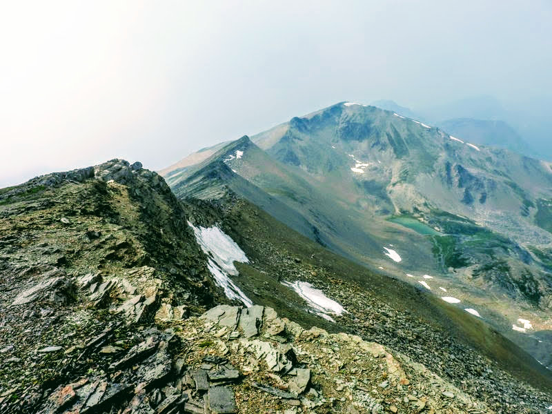
Ridge connecting Trowel Peak to Mt. Aberhart.
Skyline Six-Pack Complete GPX track
Contains the complete, normal Skyline trail plus all seven Skyline Six-Pack peaks.
Skyline Six-Pack - Parry Loeffler.gpx* This track is not meant to replace a guidebook. Consult a guidebook for route information. This track is not high resolution, so don't rely on it for route finding at a micro level *

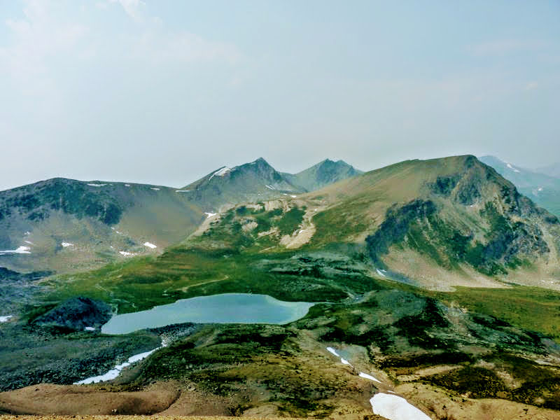
Beautiful alpine meadows.
Only 1%
Only 1% of my trips are on this website. For loads of unique adventure ideas browse my Youtube channel - they're all there with more being added all the time!
CONGRATULATIONS! Whether you've completed the normal Skyline route or added on the Six-Pack, you've surely had an incredible experience you should be proud of accomplishing. Now... what's next?
Notice of Liability and Disclaimer
I do not represent or warrant the accuracy of any of the information here as conditions in the mountains are in a constant state of flux. Climbers use this information entirely at their own risk. It is merely a trip report and not meant as a substitute for a guidebook describing the route in full. Parry Loeffler and parryloeffler.com disclaim liability for any injuries or other damage that may be sustained by anyone using the trip report found here. Refer to a guidebook for complete route information.